Wild Coast Publishing
233 Discovery Islands South Kayaking and Boating Map
233 Discovery Islands South Kayaking and Boating Map
Couldn't load pickup availability
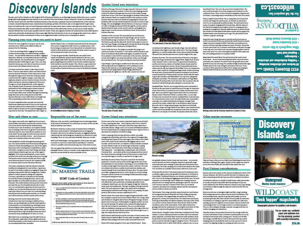
About this region: Quadra and Cortes Islands are the largest of the Discovery Islands, an archipelago loosely defined to cover a varied geographical grouping that also includes East and West Thurlow Islands, Sonora, Maurelle, Read, the Rendezvous Islands, Stuart and East and West Redonda islands. It has become a popular tourism destination for all the obvious reasons: meandering waterways, mountainous backdrops, pristine shorelines and a real opportunity to get away from it all without the risks or travel distances inherent in many other more remote and exposed coastal areas. The Discovery Islands also offer an incredible mix of land features that add to the charm, as you can as easily explore islands without the need to put a paddle near the water.
The resolution is 1:61,535. Use it for:
- Trip planning and logistics.
- Hazards and anticipated on-water conditions.
- Itinerary and holiday suggestions.
- Calculating distances and travel times.
- Regional features and attractions.
Depth soundings are not included. This Deck Topper series is intended to augment marine travel and not to be used for technical motorized vessel navigation or to replace approved Hydrographic Services charts. Kayakers, canoeists and other self-propelled craft that do not require depth soundings for transit will find it sufficient for travel without other resources. Hikers can use this mapsheet series to locate hikes in the Discovery Islands.
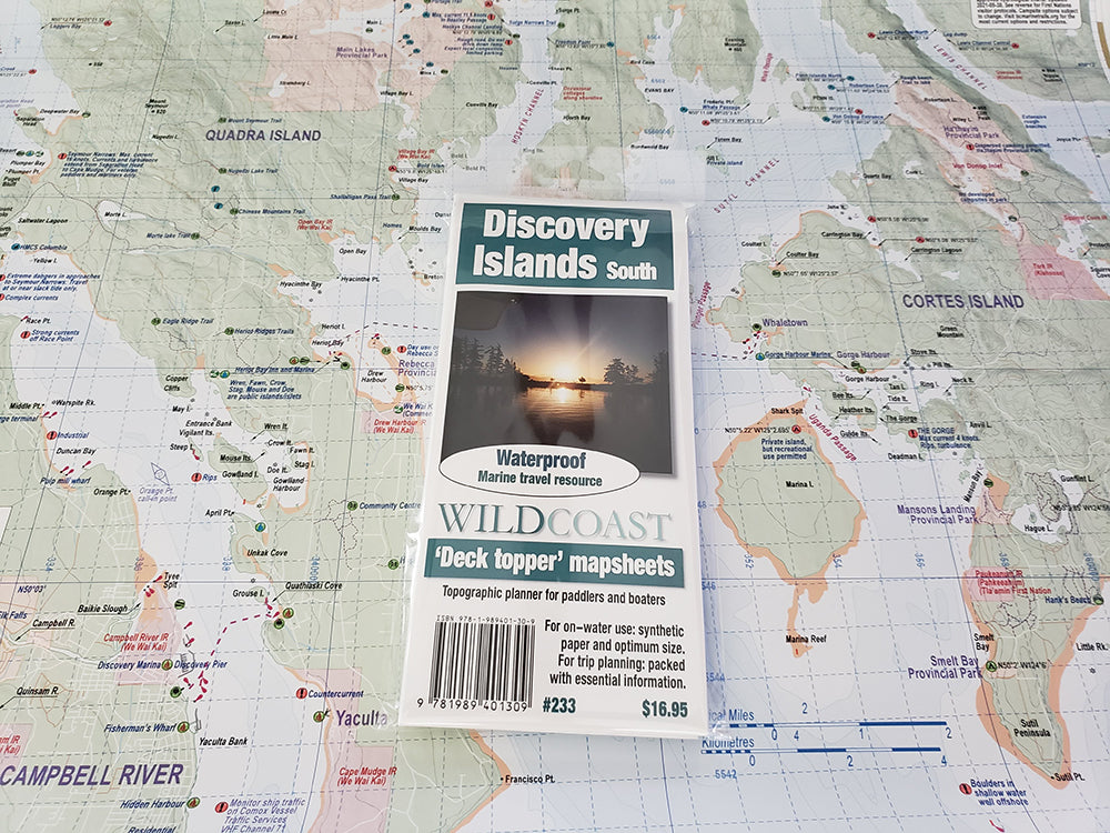
The mapsheet construction: This mapsheet uses the latest printing technology to provide a high-quality printed image on waterproof/durable synthetic polymer stock. The stock is is significantly thicker than most papers at 10 mil weight, making it extremely durable.
New! All 200-series mapsheets now include UTM grid lines. Learn to understand and make the most of them.
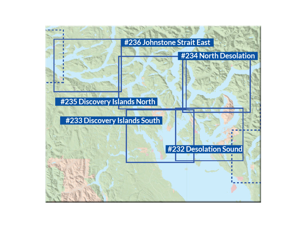
About the Desolation Sound and Discovery Island series: This new series covers the region in unrivalled detail, with each mapsheet designed to cover a specific area, as on the regional map index shown in the product images:
#232 Desolation Sound: This mapsheet covers the immediate waters around Desolation Sound, and so is perfect for launches from Lund or Okeover Inlet into the provincial park attractions such as Copeland and Curme islands. It also covers the surrounding area for wider trips into the region, including most of Cortes Island and attractions such as Manson Landing, Marina Island and Gorge Harbour, making it ideal for regional excursions from the Sunshine Coast launches. The southern extent includes beautiful Savary Island.
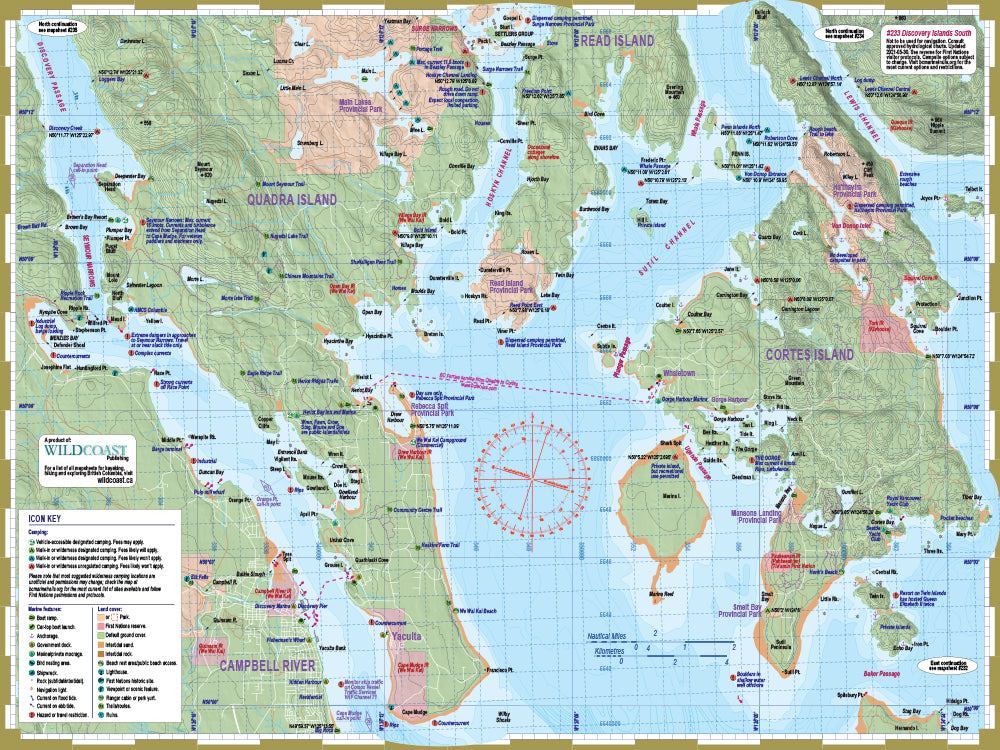
#233 Discovery Islands South: This mapsheet is for anyone starting their adventure on or near Quadra Island, and so is ideal for anyone planning a trip into the area starting from a Vancouver Island launch location. It includes Discovery Passage and Seymour Narrows, Heriot Bay and Rebecca Spit, and Hoskyn Channel up to Surge Narrows. It also includes all of Cortes Island for those planning a stay there or a circumnavigation. Use it for land attractions and hiking trails as well on both Quadra Island and Cortes.
#234 North Desolation: This is for extended trips into the Desolation Sound region, and includes all of the Redonda Islands, Toba Inlet, north Cortes Island and the gateway channels to locations farther afield (Pryce Channel and Calm Channel). It is a necessity for anyone extending their trip into Desolation Sound north beyond the park borders.
#235 Discovery Islands North: This mapsheet covers the Discovery Island region from Surge Narrows north, so includes all of Sonora Island and the surrounding attractions such as the Octopus Islands, but also all of Okisollo Channel and the wider waterways including Nodales Channel and Yaculta Rapids. Because of the type of environment, much of the textual information is dedicated to assisting with navigating the currents.
The Desolation-Discovery Expedition 4-Pack: Purchase the mapsheets together and save in our new four-pack.
Shipping information: Please read the information in the link before ordering, as doing so will help determine if you will receive your order in time for your trip. See shipping alerts and shipping policy details here.
Share