Wild Coast Publishing
235 Discovery Islands North Kayaking and Boating Map
235 Discovery Islands North Kayaking and Boating Map
Couldn't load pickup availability
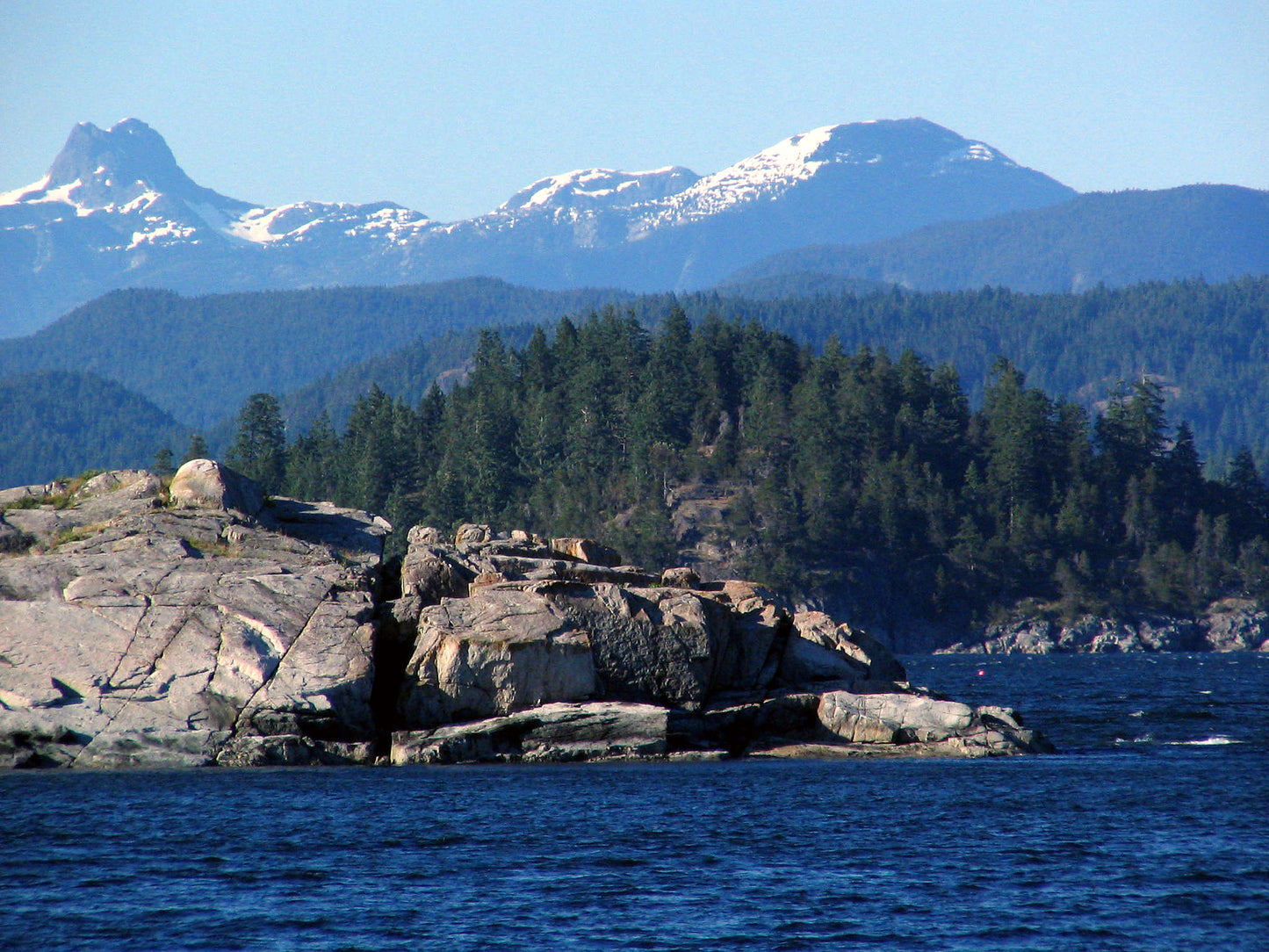
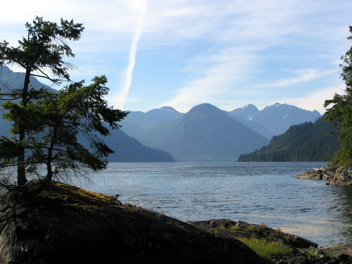
About this region: Visiting this region leaves behind the population centres of Quadra and Cortes Island and heads into the more remote northern waters, where both attractions and challenges abound. Most paddlers tend to stick to Okisollo Channel with its myriad camping opportunities and often head to Octopus Islands, the main provincial park in the area. Those venturing afield will find isolated campsites and a scattering of parks but mostly tidal passages infrequently visited.
Features:
- Designed by kayakers and explorers who are experts in this region.
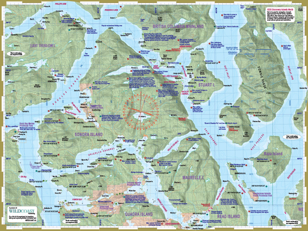
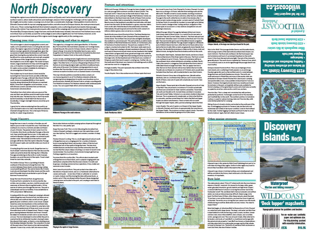
- Includes North Quadra Island, Sonora Island, the Octopus Islands, and as far south as Surge Narrows. The flipside includes a handy expanded view of Surge Narrows.
- All land and marine features of interest, including campsites, launch points, rest stop, attractions and hazards.
- UTM grid lines for easy distance calculations. Learn to understand and make the most of them.
- Our in-house printing allows frequent product updates to ensure the latest information.
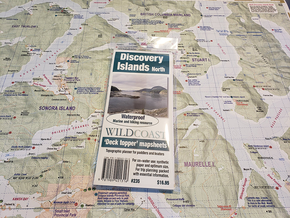
- Printed on extremely waterproof/durable 10-mil stock when 4.3-mil stock is the norm.
- Planning and logistical information is included on the opposite side of the main map to help make your adventure come to life.
- Optimal size and format for use both at home for planning and on-water during your travels.
- Augment your GPS navigation with a handy visual overview as you travel and as you plan your next day's agenda. In combination you will be well prepared for your adventure.
- Use alone without electronic assistance by navigating the traditional way without reliance on batteries or connectivity. Truly disconnect!
Don't forget! This mapsheet is part of a series. Make sure you have the correct mapsheets for your trip, and purchase bundle packages to save $$ if you need more than one mapsheet to complete your adventure!
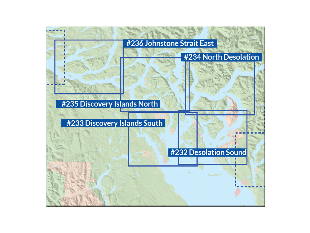
About the Desolation Sound and Discovery Island series: This new series covers the region in unrivalled detail, with each mapsheet designed to cover a specific area, as on the regional map index shown in the product images:
#232 Desolation Sound: This mapsheet covers the immediate waters around Desolation Sound, and so is perfect for launches from Lund or Okeover Inlet into the provincial park attractions such as Copeland and Curme islands. It also covers the surrounding area for wider trips into the region, including most of Cortes Island and attractions such as Manson Landing, Marina Island and Gorge Harbour, making it ideal for regional excursions from the Sunshine Coast launches. The southern extent includes beautiful Savary Island.
#233 Discovery Islands South: This mapsheet is for anyone starting their adventure on or near Quadra Island, and so is ideal for anyone planning a trip into the area starting from a Vancouver Island launch location. It includes Discovery Passage and Seymour Narrows, Heriot Bay and Rebecca Spit, and Hoskyn Channel up to Surge Narrows. It also includes all of Cortes Island for those planning a stay there or a circumnavigation. Use it for land attractions and hiking trails as well on both Quadra Island and Cortes.
#234 North Desolation: This is for extended trips into the Desolation Sound region, and includes all of the Redonda Islands, Toba Inlet, north Cortes Island and the gateway channels to locations farther afield (Pryce Channel and Calm Channel). It is a necessity for anyone extending their trip into Desolation Sound north beyond the park borders.
#235 Discovery Islands North: This mapsheet covers the Discovery Island region from Surge Narrows north, so includes all of Sonora Island and the surrounding attractions such as the Octopus Islands, but also all of Okisollo Channel and the wider waterways including Nodales Channel and Yaculta Rapids. Because of the type of environment, much of the textual information is dedicated to assisting with navigating the currents.
The Desolation-Discovery Expedition 4-Pack: Purchase the mapsheets together and save in our new four-pack.
About the Wild Coast map series: In 2019, Wild Coast Publishing began embarking on an ambitious program to provide an unbroken series of mapsheets covering the entire BC coastline. The series begins with mapsheet #201 Brooks Peninsula and extends in order down the outer Vancouver Island and up the southern BC coast then finally north through the Inside Passage. You can view the currently available list of mapsheets here. The maps are designed for paddlers and boaters, right down to the size -- a handy 24x18", slightly smaller than a traditional street map and so easy to manage when on the water. Use it as a "deck topper" for easy visualization as you travel on the water, use it around the campfire or your anchorage at night to plan your next day's route, and at home for research when your journey is still in the dream stage.
Shipping information: Please read the information in the link before ordering, as doing so will help determine if you will receive your order in time for your trip. See shipping alerts and shipping policy details here.
Share