Wild Coast Publishing
614 South Vancouver Island Expedition 7-Pack
614 South Vancouver Island Expedition 7-Pack
Couldn't load pickup availability
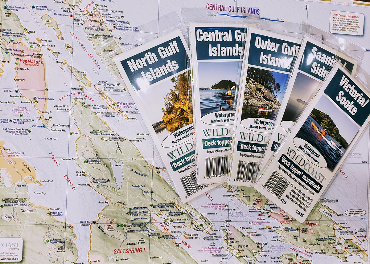
This package assembles all six South Vancouver Island 'Deck Topper' mapsheets and the #501 Chart Assistant into one bundle. This is designed for transits from Sooke to Nanaimo, or for regular users of these popular desinations including all of the Gulf Islands.
Packaged in this bundle are:
#214: Juan de Fuca: This mapsheet covers Port San Juan and Port Renfrew to Sooke.
#215 Victoria-Sooke: Use for trips around the south end of Vancouver Island and explorations of Sooke, Esquimalt and Victoria, north to Cordova Bay.
#216 Saanich-Sidney: Use for trips originating into the nearby Gulf Islands from Sidney and Saanich Peninsula. Use also for Saanich Inlet. Ideal for adventures from D'Arcy Island to Portland Island.
#217 Outer Gulf Islands: This covers many the easternmost of the Gulf Islands including Saturna, Mayne and the Pender Islands. Includes Montague Harbour on Galiano Island.
#218 Central Gulf Islands: For trips involving Galiano Island, including Active Pass, Mayne Island and points north as far as Porlier Pass and Thetis/Penelakut islands including Sansum Narrows.
219 North Gulf Islands: For trips involving Nanaimo, Gabriola and Valdes islands, as well as trips as far south as Ladysmith including the De Courcy Group and Pirates Cove.
#501 Victoria-Gulf Islands Chart Assistant: This larger regional overview covers the entire region of the Deck Toppers in one mapsheet. Use it for better overall orientation and use the Deck Toppers for more detailed exploration area by area.
The series is designed to work together with overlaps to ensure a beneficial regional perspective from all maps and no chance of having to navigate between mapsheet edges.
About the Deck Topper Kayaking and Boating map series: Starting in 2019, Wild Coast Publishing began embarking on an ambitious program to provide an unbroken series of mapsheets covering the entire BC coastline. The series begins with mapsheet #201 Brooks Peninsula and extends in order down the outer Vancouver Island coast before covering the entire south BC coast. You can view the mapsheets here. The maps are designed for paddlers and boaters, right down to the size -- a handy 24x18", slightly smaller than a traditional street map and so easy to manage when on the water. Use it as a "deck topper" for easy visualization as you travel on the water, use it around the campfire or your anchorage at night to plan your next day's route, and at home for research when your journey is still in the dream stage.
Shipping information: See shipping alerts and shipping policy details here.
Share