Wild Coast Publishing
638 Broughton-Johnstone Expedition Map 3-Pack
638 Broughton-Johnstone Expedition Map 3-Pack
Couldn't load pickup availability
This package assembles the three Broughton-Johnstone mapsheets into one useful bundle. The package includes:
#238 Telegraph Cove. The essential mapsheet for journeys into Johnstone Strait and the Broughton Archipelago, this map covers the southern area of Broughton Archipelago and Johnstone Strait to Robson Bight, the killer whale reserve.
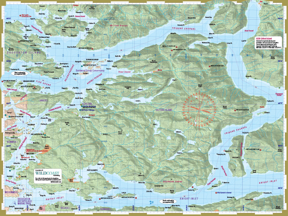
#239 Gilford Island. The extension into the northeast section of the region and the interiors waters including Tribune Channel, lower Knight Inlet and Kingcome Inlet. Necessary if your trip includes Echo Bay, Fife Sound, or the north section of Broughton Archipelago Provincial Park.
#240 North Broughtons. The companion to #238, this extends northward covering the northern section of Broughton Archipelago into Grappler Sound including the Broughton Islands.
About the Wild Coast map series: In 2019, Wild Coast Publishing began embarking on an ambitious program to provide an unbroken series of mapsheets covering the entire BC coastline. The series begins with mapsheet #201 Brooks Peninsula and extends in order down the outer Vancouver Island and up the southern BC coast then finally north through the Inside Passage. You can view the currently available list of mapsheets here. The maps are designed for paddlers and boaters, right down to the size -- a handy 24x18", slightly smaller than a traditional street map and so easy to manage when on the water. Use it as a "deck topper" for easy visualization as you travel on the water, use it around the campfire or your anchorage at night to plan your next day's route, and at home for research when your journey is still in the dream stage.
Shipping information: See shipping alerts and shipping policy details here.
Share