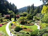
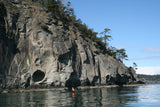
Goldstream Provincial Park is a fantastic wilderness area at the head of Saanich Inlet whose greatest misfortune is being located alongside the busy Malahat Drive. The park protects the estuary of Goldstream River along with an old-growth Douglas-fir forest in the picturesque setting of a hanging valley complete with a 47-metre waterfall. An annual attraction is the chum and coho salmon run, when as many as 25,000 salmon attempt to beat the currents of Goldstream River to reach the spawning beds. The park is an excellent observation point for watching the salmon, along with the many eagles drawn to the feast, in late October and November.
History: A prospector named Peter Leech first called the river Gold Creek in 1858. Despite a minor gold rush, very little gold was actually found. The last evidence is some small workings near the Gold Mine Trail.
Day use: The day-use area off the north parking lot features sheltered picnic areas, fire rings, washrooms and the year-round Freeman King Visitor Centre and its interpretive programs. Some of the park’s river pools are suitable for swimming, particularly near the campground’s gatehouse – if you don't mind frigid water.
Hiking: A trail leads along a boardwalk to an observation platform overlooking the Goldstream River estuary near the visitor centre. Another trail, the Arbutus Loop, is located near the campground, as is a trail to Goldstream Falls. Portions of the shorter trails are wheelchair-accessible. For more determined hikers, the park features a total of 16 km of trails of varying degrees of difficulty. The Arbutus Ridge Trail links the campground to the visitor centre, about 6 km return. A more difficult route is a clamber to the alpine-like peak of Mount Finlayson. The ascent from the south begins just off the visitor centre parking lot across the bridge over the Goldstream River. Portions are steep, rocky and quite difficult. The north route from Finlayson Arm Road is less demanding but also less scenic. An unfortunate incursion is the Bear Mountain housing and resort development adjacent to Mount Finlayson, so that a previous forest ridge along the ascent is now condos and a golf course.
Camping: Vehicle-accessible camping is located at the south entrance of the park. Facilities include campfires, showers, water, a sani-station and amphitheatre. Group camping is located off the park headquarters on the south end of the park. Reservations are taken May to September 4.
Cycling: Bicycles are only allowed along the visitor centre trail. Public access, including boat use, is banned at the estuary.
Traffic: The park is located along a potentially dangerous section of the Malahat Drive in a valley bottom, which makes left-hand turns potentially dangerous despite safety improvements and road widening.


