Wild Coast Publishing
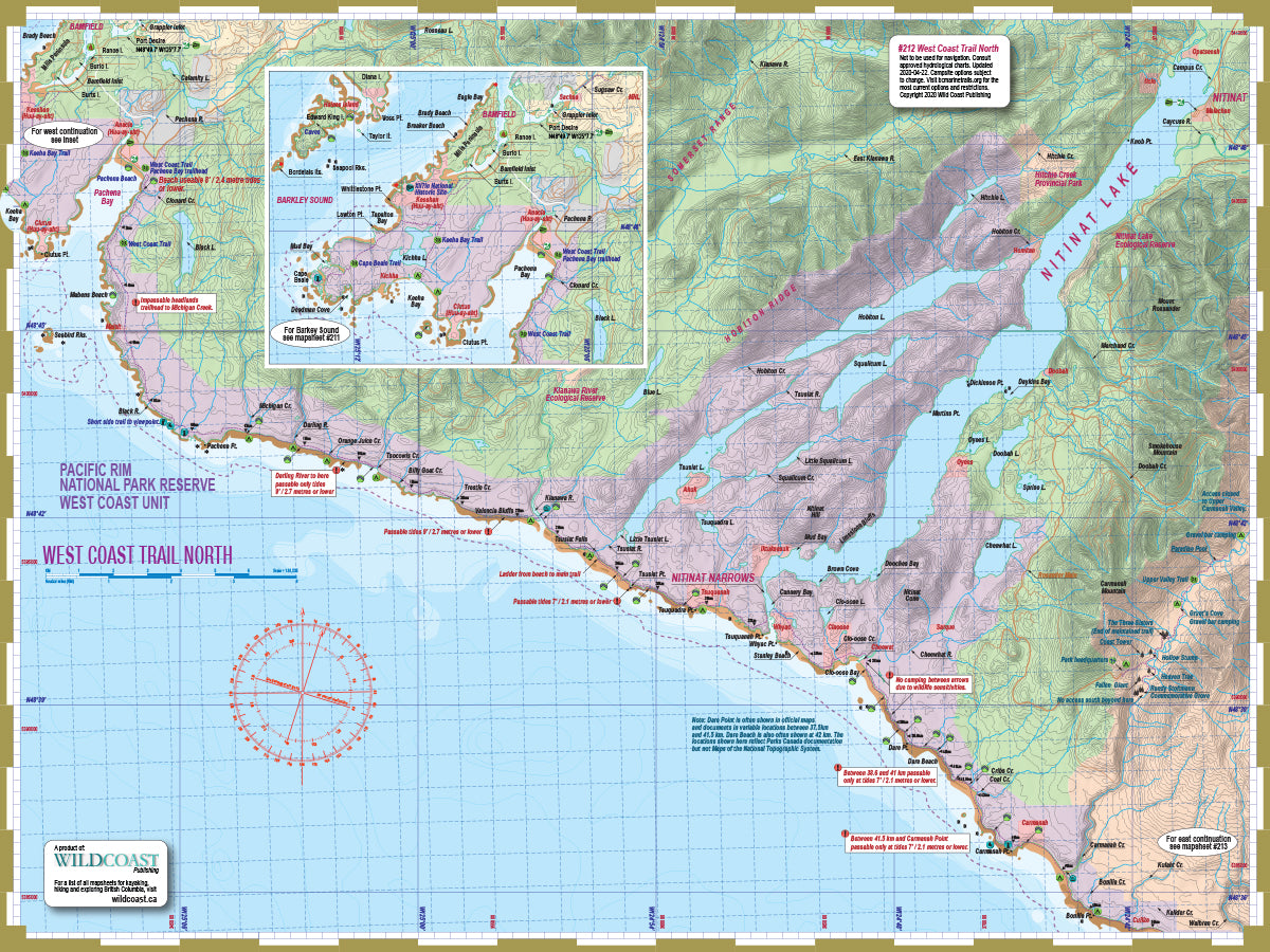
212 West Coast Trail North Trail and Marine Map
212 West Coast Trail North Trail and Marine Map
Couldn't load pickup availability
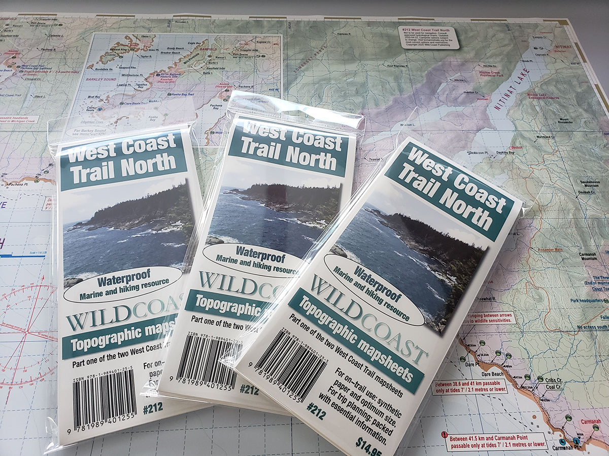
Updated for 2025. All 2025 editions purchased through online orders will be shipped with a clip to maintain the folds rather than a plastic wrapper to reduce plastic consumption.
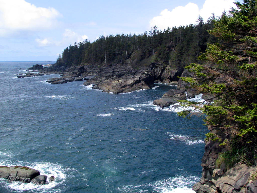
About the West Coast Trail: Vancouver Island’s West Coast is renowned for the rugged scenery, and the West Coast Trail is a large part of the reason why. Protected within the Pacific Rim National Park Reserve, the trail wends its way 75 kilometres across steep headlands, through valleys, over rivers and along expansive stretches of surf-battered beach. Frequent boardwalks, bridges, stairs, ladders and even cable cars are the human elements where otherwise hikers must simply push through steep, rocky and occasionally boggy terrain when the beaches run out – as they often do. Low tide ensures a much greater option of beach routes. The reward for the effort of completing the trail is the opportunity to drink in the richness of the outer Vancouver Island coast, and there is no other place quite like it.
About this mapsheet: This mapsheet covers the West Coast Trail as a hiking resource, and expands the coastal route into a regional overview including Nitinat Lake and Carmanah Valley, for those who want to turn a trail hike into a larger exploration of the region. But it is also a marine mapsheet to facilitate a coastal transit as part of the Wild Coast marine mapsheet series that when complete will provide an unbroken overview of the entire British Columbia coastline. As such it is part of the hybrid Wild Coast marine and trail mapsheet series. It should be coupled with Mapsheet #213 West Coast Trail South to complete the trail in its entirety.
The mapsheet layout: The main map sheet covers the West Coast Trail from the Pachena Bay (Bamfield) trailhead through to Carmanah Beach. It also includes the Bamfield area and trails to Keeha Bay and Cape Beale. The map also covers the interior of the region to cover Nitinat Lake and the third possible access to the coast, the community of Nitinat. The reverse trail planning information, details of the trail by segment and details of the larger region including Carmanah Valley and Bamfield.
The mapsheet construction: The mapsheet is created by Wild Coast Publishing using some of the latest technology available to provide a high-quality printed image on waterproof/durable synthetic polymer stock. The stock is picked as the best for the purpose, and is significantly thicker than most papers at 10 mil weight.
New! All 200-series mapsheets now include UTM grid lines. Learn to understand and make the most of them.
Don't forget the guide book: The perfect companion to the mapsheet is the BC Coast Explorer Vol. 2, which goes into much greater details about the features, attractions travel logistics and history.
About the Wild Coast map series: In 2019, Wild Coast Publishing began an ambitious program to provide an unbroken series of mapsheets covering the entire BC coastline. The series begins with mapsheet #201 Brooks Peninsula and extends in order down the outer Vancouver Island and up the southern BC coast then finally north through the Inside Passage. You can view the currently available list of mapsheets here. The maps are designed for paddlers and boaters, right down to the size -- a handy 24x18", slightly smaller than a traditional street map and so easy to manage when on the water. Use it as a "deck topper" for easy visualization as you travel on the water, use it around the campfire or your anchorage at night to plan your next day's route, and at home for research when your journey is still in the dream stage.
Get the West Coast Trail pack: Two mapsheets are needed to complete the entire trail. Buy both in a bundle and save.
Shipping information: Please read the information in the link before ordering, as doing so will help determine if you will receive your order in time for your trip. See shipping alerts and shipping policy details here.
Share