
Wild Coast Publishing
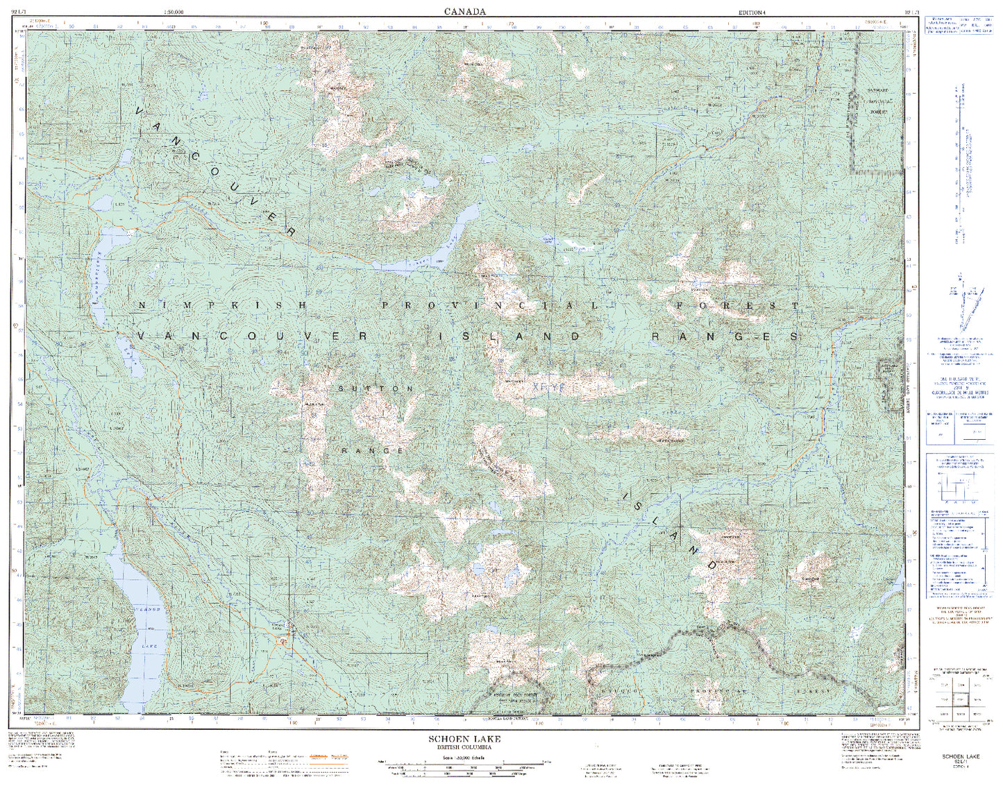
092L01 Schoen Lake
092L01 Schoen Lake
Couldn't load pickup availability
These maps published by Natural Resources Canada are standard, highly detailed, area-specific sheets from Canada’s National Topographic System. These maps were produced to portray natural terrain, hydrography, vegetation, built features, and grid/datum information accurately at a scale useful for field navigation and professional analysis. These maps represent the last of the Government of Canada printing for these publications and once sold will never be available again.
These topo maps have a wide range of uses:
Recreational
-
Hiking, backpacking, camping, canoeing, mountain biking, and orienteering.
-
Used with a compass for land navigation and route planning. Natural Resources Canada
Professional and Technical
-
Environmental assessment, flood and wildfire planning, forest management, and land-use planning.
-
Engineering, resource development, and emergency response planning. Natural Resources Canada
Surveying and GIS
-
Many professionals digitize these maps or integrate them into GIS for analysis or base mapping.
The 1:50 000 scale series is one of the two primary NTS scales (the other being 1:250 000). At 1:50 000, 1 cm on the map equals 500 m on the ground. This scale provides a detailed view appropriate for navigation, planning, and geographic analysis.
Natural Features
-
Terrain and relief via brown contour lines showing elevation changes and landform shapes.
-
Hydrography (blue) illustrating lakes, rivers, streams, swamps, rapids, falls, and other water features.
-
Vegetation cover such as forests and wooded areas marked in green.
Human and Cultural Features
-
Transportation networks: major and secondary roads, trails, railways.
-
Infrastructure and facilities: buildings, power lines, bridges, and other man-made elements.
Grids and Datum
-
The map uses a Universal Transverse Mercator (UTM) grid (with 1 000 m ticks) printed on the sheet for coordinate referencing and navigation.
-
Latitude and longitude tick marks appear along the map edges for geolocation.
Magnetic Declination
Share
Get free shipping! Order two to three items with this order instead of just this one and we'll ship them to you at no cost!