Wild Coast Publishing
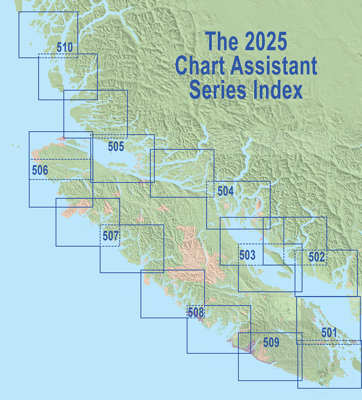
504 Desolation/Johnstone Inside Passage Chart Assistant
504 Desolation/Johnstone Inside Passage Chart Assistant
Couldn't load pickup availability
Area covered: This mapsheet covers Desolation Sound and the Discovery Islands including Cortes, Quadra and Redonda islands as well as adjacent waterways through Johnstone Strait to Port Neville.
Resolution is 1:123,070. Use it for:
- Calculating distances and travel times.
- Choosing destinations including campsites and anchorages.
- For familiarity with the coast to augment visualizations more clearly than possible with electronic charting systems alone.
- Discover land features and details not included on charts.
Depth soundings are not included. This series is intended to augment marine travel and not to be used for technical navigation or to replace approved Hydrographic Services charts. Kayakers, canoeists and others may find it sufficient for travel without other resources. However, Wild Coast Publishing recommends the more detailed Deck Topper series for navigation by small and self-propelled craft for the better scale and additional detail.
About the Chart Assistant series: The Inside Passage Chart Assistant series covers the entire BC coastline from Washington State to Alaska in a uniform scale for consistent application. All Chart Assistants are printed on heavy synthetic paper to withstand the toughest conditions. The new #500 series replaces the individual mapsheets in the previous #300 series and are all double-sided with map information only, unlike the Deck Toppers which provide additional textual logistical and travel planning information. Use the Chart Assistants for transits and visual trip planning and logistics, and the Deck Toppers for more detailed holiday planning.
Combining with Deck Toppers: These mapsheets can be used in combination with the Deck Topper series to fill in the vast majority of the southern British Columbia coast in greater detail, as Deck Toppers are twice the resolution, and cover the area in more detail including text descriptions for hazards, features and attractions, campsites, launch sites and much more.
UTM Grid Lines: All 500-series mapsheets include UTM grid lines. Learn to understand and make the most of them.
Shipping information: Make sure to select the correct shipping method for your needs. If purchasing outside Canada, our shipping information could be critical in ensuring you receive your package in time for your trip. See shipping alerts, helpful tips and what to expect here.
Share