Wild Coast Publishing
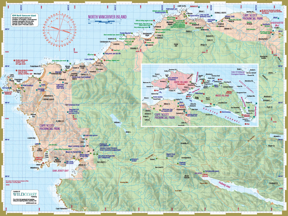
244 North Vancouver Island Kayaking and Boating Map
244 North Vancouver Island Kayaking and Boating Map
Couldn't load pickup availability
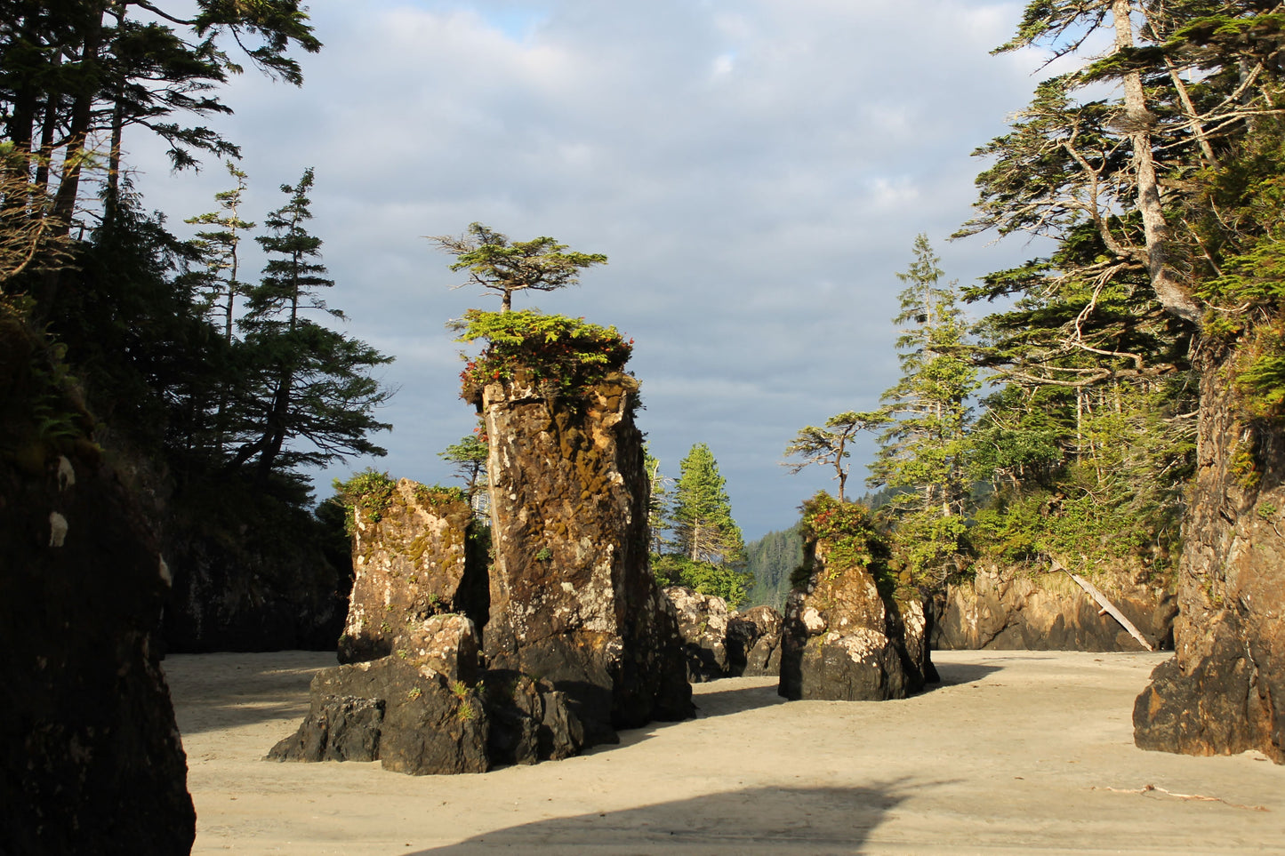
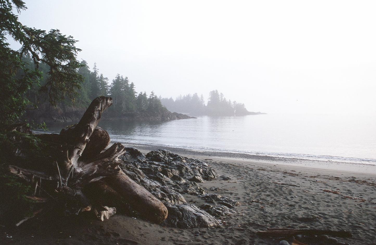
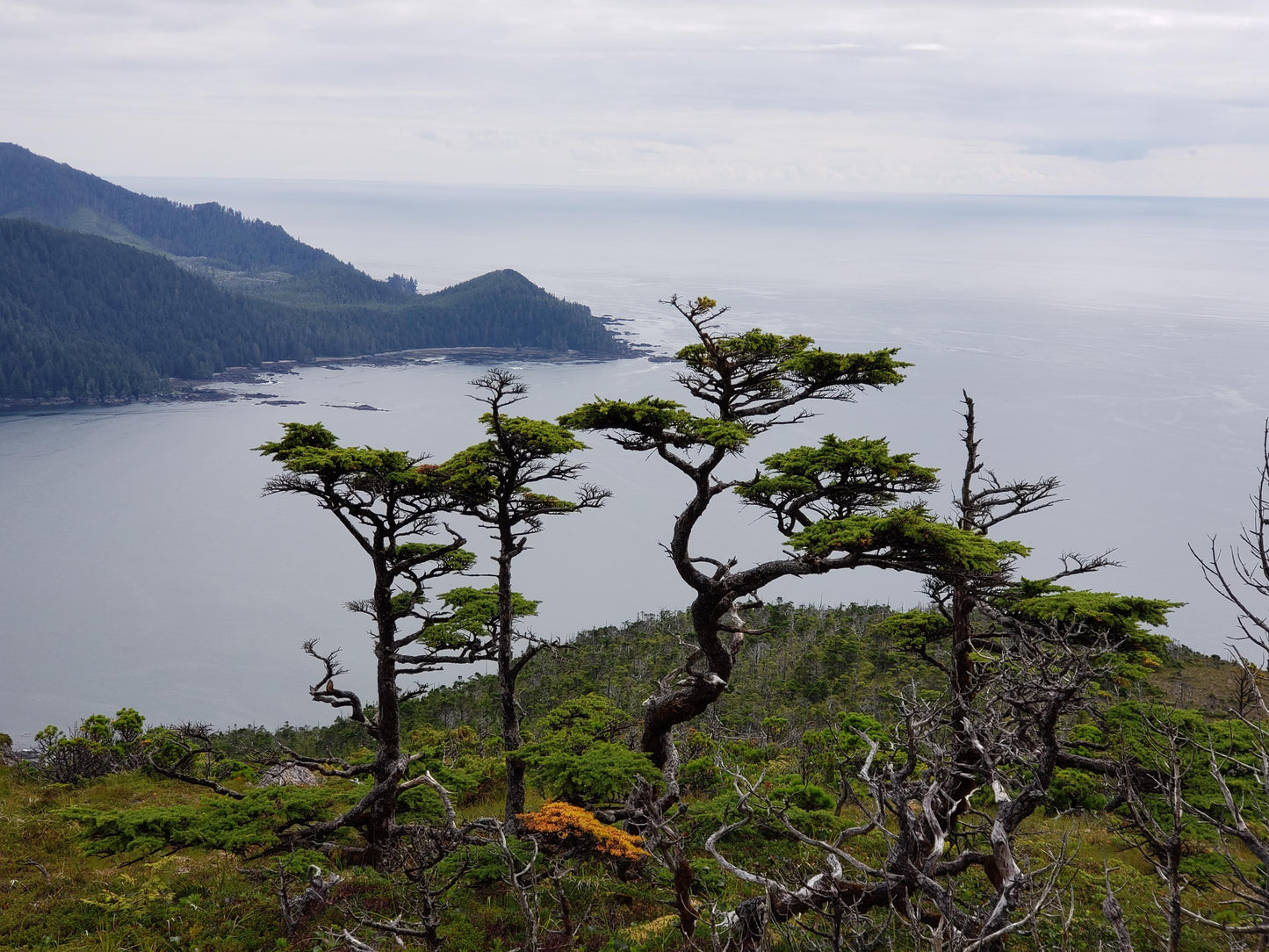
About this mapsheet: This mapsheet covers north Vancouver Island from Shushartie Bay to San Josef Bay, including all of Cape Scott Provincial Park and the North Coast Trail.
The scale is  1:71,428. Use it for:
- Trip planning and logistics.
- Hazards and anticipated on-water conditions.
- Itinerary and holiday suggestions.
- Calculating distances and travel times.
- Regional features and attractions.
Depth soundings are not included. This Deck Topper series is intended to augment marine travel and not to be used for technical motorized vessel navigation or to replace approved Hydrographic Services charts. Kayakers, canoeists and other self-propelled craft that do not require depth soundings for transit will find it sufficient for travel without other resources.
A note about scale: This mapsheet differs from the other "Deck Topper" mapsheets produced by Wild Coast Publishing by being a slightly different scale. This allows both Shushartie Bay and Cape Scott to be placed on a single mapsheet, accommodating all of Cape Scott Provincial Park. Other Deck Toppers are produced at a scale of 1:61,535 for consistency between mapsheets.
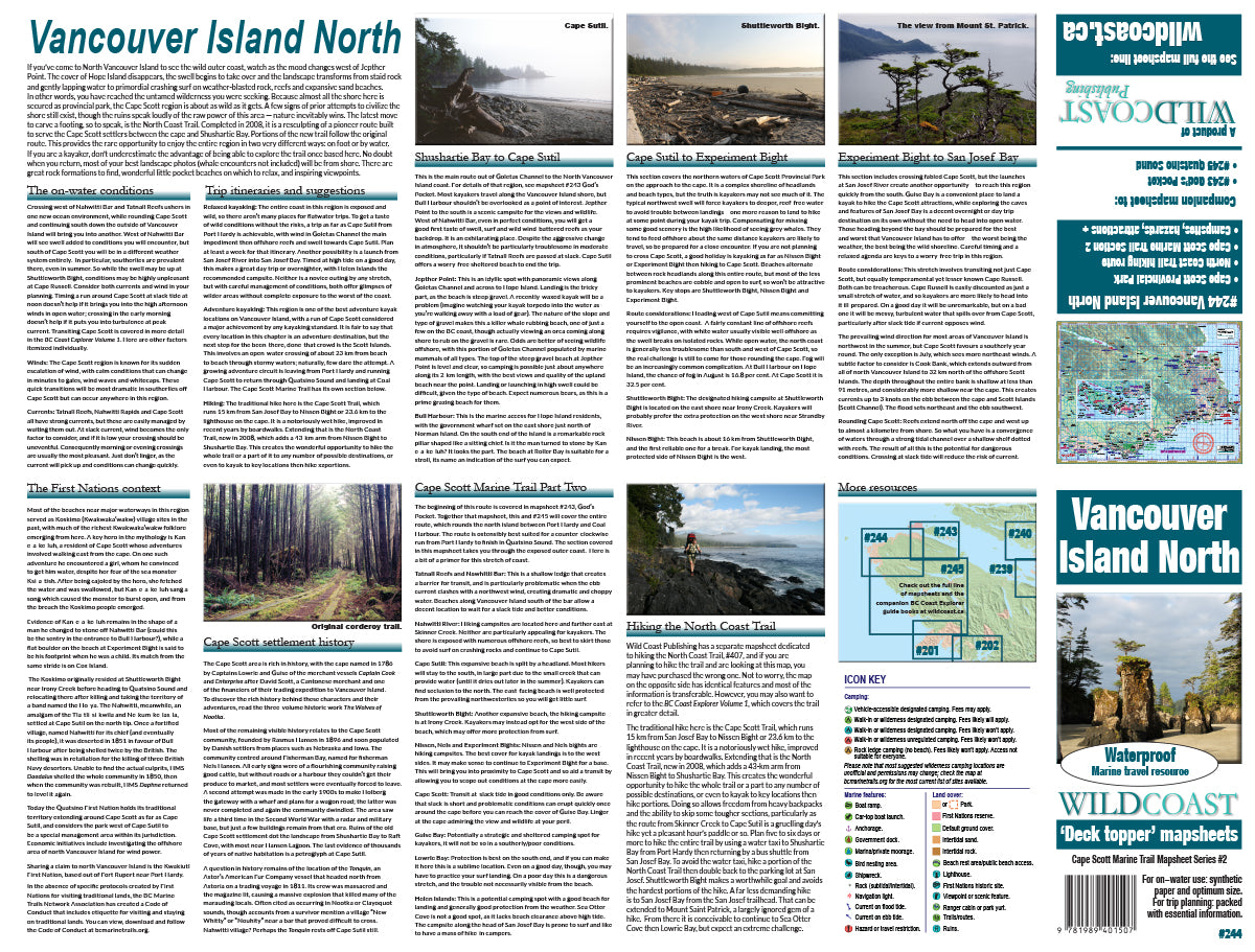
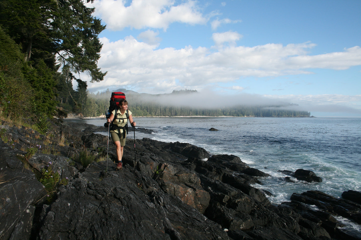
For the North Coast Trail: Wild Coast Publishing produces a separate mapsheet dedicated to the North Coast Trail, #407. That mapsheets includes additional details for hikers. Please note the maps are otherwise essentially identical and this map can serve both purposes of trail hiking and marine travel.
For the Cape Scott Marine Trail: A formal kayaking/paddling route exists that runs from Port Hardy to Coal Harbour around north Vancouver Island. It is an exceptional opportunity for expert paddlers. To use the Wild Coast Publishing mapsheets to complete this epic voyage, use mapsheets #243-245. The three mapsheets can be purchased as a bundle.
The mapsheet construction: The mapsheet is created by Wild Coast Publishing using some of the latest technology available to provide a high-quality printed image on waterproof/durable synthetic polymer stock.
New! All 200-series mapsheets now include UTM grid lines. Learn to understand and make the most of them.
Don't forget the guide book: The perfect companion to the mapsheet is the BC Coast Explorer Vol. 1, which goes into much greater details about the features, attractions travel logistics and history.
About the Wild Coast map series: In 2019, Wild Coast Publishing embarked on an ambitious program to provide an unbroken series of mapsheets covering the entire BC coastline. The series begins with mapsheet #201 Brooks Peninsula and extends in order down the outer Vancouver Island coast and up the southern BC coast then finally north through the Inside Passage. You can view the currently available list of mapsheets here. The maps are designed for paddlers and boaters, right down to the size — a handy 24x18", slightly smaller than a traditional street map and so easy to manage when on the water. Use it as a "deck topper" for easy visualization as you travel on the water, use it around the campfire or at your anchorage at night to plan your next day's route, and at home for research when your journey is still in the dream stage.
Shipping information: Please read the information in the link before ordering, as doing so will help determine if you will receive your order in time for your trip. See shipping alerts and shipping policy details here.